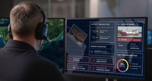
Geo-data firm Fugro has agreed a partnership with software provider DTACT and AI satellite company Ubotica to develop an intelligence platform to support maritime situational awareness and the protection of underwater infrastructure.
The platform is designed to assist government organisations in identifying and responding to risks around subsea assets such as pipelines and communication cables.
Fugro will contribute Geo-data from its uncrewed surface vessels, underwater vehicles and aerial drones, managed via remote operations centres. Ubotica will supply satellite tracking data through its AI-powered onboard processing systems, while DTACT will provide the data fusion architecture to combine these inputs with additional intelligence streams.
“Real-time intelligence is transformative for maritime situational awareness. The combined space-to-seabed surveillance and response capability that we are developing through this partnership is a game-changer,” said Fintan Buckley, CEO of Ubotica.
“This integrated approach, bringing together our insights with Fugro and DTACT, creates enhanced maritime awareness and a near real-time response capability that will secure critical underwater infrastructure well into the future.”
Initial applications will focus on government users in the North Sea and Baltic Sea regions.