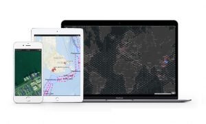
Lloyd’s List Intelligence has announced the launch of a new vessel tracking systems called AIS+, combining Automatic Identification System (AIS) data with artificial intelligence to provide insight on vessel movements, movement history, and predictive movements.
Vessel location intelligence is derived from raw AIS data, which is overlaid with the company’s ‘Geospatial Database’, allowing AIS+ users to specify location by sub-port, ship-to-ship (STS) transfer area, terminal, berth or anchorage.
The AIS data used is a combination of the company’s own terrestrial AIS data, Spire satellite and shipborne AIS, Orbcomm satellite AIS, and human intelligence. Lloyd’s List Intelligence’s terrestrial network is hosted and maintained by Lloyd’s Agents, with stations positioned in strategically important ports. Agents can also provide first-hand vessel sighting information to identify indicators of deceptive shipping practices like AIS gaps and dark port callings.
Data can be delivered via API or FTP directly into users’ existing systems and workflows as required, the company notes.
“AIS+ reiterates our commitment to maritime intelligence, combining raw AIS data with advanced artificial intelligence to provide unparalleled insights into vessel movements,” said Parvin Conners, Chief Operating Officer, Lloyd’s List Intelligence.
“By leveraging our proprietary geospatial database and the unique blend of terrestrial, satellite, and human intelligence, AIS+ ensures the most accurate and reliable vessel tracking available.”
“Our AIS+ solution, powered by SeaTech, a combination of differentiated data, context and support, not only enhances operational efficiency but also empowers our customers across diverse sectors to optimise their strategies and gain a competitive edge.”
AIS+ can be combined with a one-off delivery of historical data going back to 2008 for initial model building and analysis.