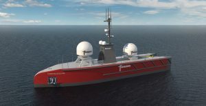
Woolpert reports that it is conducting its first fully uncrewed offshore hydrographic survey mission for the National Oceanic and Atmospheric Administration (NOAA) off the coast of Pensacola, Florida.
The project involves deploying multiple Uncrewed Survey Vessels (USV) designed and piloted by Chance Maritime to map deep-sea corals and ocean habitats. The mission will collect more than 4,770 square kilometres of high-resolution data to identify seafloor hazards and update nautical charting products.
“New maps of seafloor bathymetry and texture will be used by NOAA and our partners to develop new habitat maps and characterisations supporting the restoration of mesophotic and deep benthic communities in the region that were damaged during the Deepwater Horizon oil spill,” said Chris Taylor, Ecologist with NOAA National Centres for Coastal Ocean Science.
The survey utilises two USV models, the Chance MC40, a high-power long-endurance vessel, as well as the Chance MC29. These vessels allow for continuous remote operations without crews on board.
Data is uploaded via Starlink satellite communications to a cloud server and ingested into Woolpert’s Automatic Survey Production Environment (ASPEN) for processing.
“Uncrewed vessels allow us to collect high-quality hydrographic data more efficiently and safely, particularly in challenging deep-ocean environments,” said Dave Neff, Woolpert Program Director.
The multi-month project involves surveying approximately 11,000 linear nautical miles, with hydrographers positioned across multiple time zones to remotely conduct the surveys around the clock.