The International Hydrographic Organization (IHO) has announced the adoption of the first set of operational standards within the S-100 framework, expected to significantly improve digital maritime navigation.
The move paves the way for Coastal States to offer products and services based on these standards and also has implications for ocean data collection and sea surveys, as these new products will require enhanced data.
“The availability of operational versions of these standards represents the real starting point for coastal states to embark on the journey to produce official S-100 products,” said Dr John Nyberg, Director of the Technical Programme at the IHO.
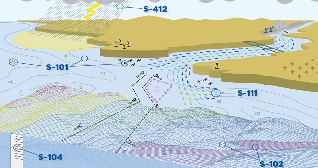
The S-100 framework enables the integration of diverse datasets within a single Electronic Chart Display and Information System (ECDIS), allowing seafarers to combine various data layers – such as Electronic Navigational Charts (ENCs), depth information and dynamic data on water level and currents – to improve situational awareness and decision-making.
The newly adopted operational editions of S-100-based Product Specifications include:
- S-101: Electronic Navigational Charts (ENCs)
- S-102: Bathymetric Surface
- S-104: Water Level Information
- S-111: Surface Currents
- S-129: Under Keel Clearance Management
The development of the remaining Phase 1 Product Specifications is ongoing, with Navigational Warnings (S-124) and the Catalogue of Nautical Products (S-128) already submitted for Hydrographic Services and Standards Committee endorsement, with approval anticipated in early 2025.
Phase 2 will focus on Product Specifications for route planning, with four key standards:
- S-122: Marine Protected Areas
- S-123: Marine Radio Services
- S-127: Marine Traffic Management
- S-131: Marine Harbour Infrastructure
From January 1, 2026, S-100 ECDIS will be legal for use, with a transition period until January 1, 2029, after which all new systems must comply with the updated IMO ECDIS Performance Standards.